Hannibal Schacht 4: Unterschied zwischen den Versionen
Zur Navigation springen
Zur Suche springen
K (Bot: Automatisierte Textersetzung (-BIILDBESCHREIBUNG1 +BILDBESCHREIBUNG1)) |
K (Bot: Automatisierte Textersetzung (-Aktueller Zustand +)) |
||
| Zeile 2: | Zeile 2: | ||
{{Infobox Schacht | {{Infobox Schacht | ||
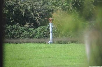
| FOTO = Zeche_Hannibal_Schacht_4.JPG | | FOTO = Zeche_Hannibal_Schacht_4.JPG | ||
| BILDBESCHREIBUNG1 = | | BILDBESCHREIBUNG1 = Hannibal Schacht 4 | ||
| NAME = Hannibal Schacht 4 | | NAME = Hannibal Schacht 4 | ||
| ALTERNATIVNAME = | | ALTERNATIVNAME = | ||
Version vom 11. Mai 2012, 17:56 Uhr
| Schachtdaten: Hannibal Schacht 4 | |
|---|---|
| Hannibal Schacht 4 | |
| Bergwerk | Hannibal |
| Teufbeginn | 1914 |
| Betriebsende | 1973 |
| Sichtbar | Protegohaube |
| Geographische Lage | |
| Standort | Bochum |
| Gemarkung | Riemke |
| Strasse | Herzogstraße |
| Koordinaten | 51° 30′ 38″ N, 7° 12′ 9″ O51.51067.20259Koordinaten: 51° 30′ 38″ N, 7° 12′ 9″ O |
|
| |
