Victoria Mathias Schacht Mathias: Unterschied zwischen den Versionen
Zur Navigation springen
Zur Suche springen
Peter (Diskussion | Beiträge) K (Links) |
Peter (Diskussion | Beiträge) (Koordinate korrigiert und Bilder hinzugefügt) |
||
| Zeile 1: | Zeile 1: | ||
{{Infobox Schacht | {{Infobox Schacht | ||
| FOTO = | | FOTO = Victoria Mathias P1050076.JPG | ||
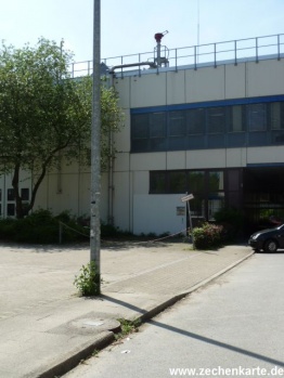
| BILDBESCHREIBUNG1 = | | BILDBESCHREIBUNG1 = Schachtdeckel und Protegohaube von Victoria Mathias Schacht Mathias in 2013 | ||
| NAME = Victoria Mathias Schacht Mathias | | NAME = Victoria Mathias Schacht Mathias | ||
| ALTERNATIVNAME = | | ALTERNATIVNAME = | ||
| Zeile 14: | Zeile 14: | ||
| SICHTBAR = Protegohaube | | SICHTBAR = Protegohaube | ||
| NACHFOLGENUTZUNG = | | NACHFOLGENUTZUNG = | ||
| GK-KOORDINATEN = | | GK-KOORDINATEN = R 25 69972,60 - H 57 03626,30 | ||
| BREITENGRAD = 51. | | BREITENGRAD = 51.462890 | ||
| LÄNGENGRAD = 07. | | LÄNGENGRAD = 07.006212 | ||
| REGION-ISO = DE-NW | | REGION-ISO = DE-NW | ||
| STANDORT = Essen | | STANDORT = Essen | ||
| Zeile 25: | Zeile 25: | ||
| LAGE_UNGENAU = | | LAGE_UNGENAU = | ||
}} | }} | ||
<gallery> | |||
Datei:Victoria Mathias P1050072.JPG|Schachtdeckel von Victoria Mathias Schacht Mathias in 2013. | |||
</gallery> | |||
==Links== | ==Links== | ||
*[http://de.wikipedia.org/wiki/Zeche_Victoria_Mathias Wikipedia] | *[http://de.wikipedia.org/wiki/Zeche_Victoria_Mathias Wikipedia] | ||
Aktuelle Version vom 29. Juni 2013, 16:23 Uhr
| Schachtdaten: Victoria Mathias Schacht Mathias | |
|---|---|
| Schachtdeckel und Protegohaube von Victoria Mathias Schacht Mathias in 2013 | |
| Bergwerk | Victoria Mathias |
| Teufe (Größte Tiefe) | 255 m |
| Teufbeginn | 1840 |
| Betriebsende | 1893 |
| Sichtbar | Protegohaube |
| Geographische Lage | |
| Standort | Essen |
| Gemarkung | Mitte |
| Strasse | Universitätsstraße |
| Gauss-Krüger-Koordinaten | R 25 69972,60 - H 57 03626,30 |
| Koordinaten | 51° 27′ 46″ N, 7° 0′ 22″ O51.462897.006212Koordinaten: 51° 27′ 46″ N, 7° 0′ 22″ O |
|
| |

