Gottfried Wilhelm Schacht 2: Unterschied zwischen den Versionen
Zur Navigation springen
Zur Suche springen
K (Bot: Automatisierte Textersetzung (-== Links == +==Links==)) |
K (Bot: Automatisierte Textersetzung (-DURCHMESSER = 4, +DURCHMESSER = 4.)) |
||
| (4 dazwischenliegende Versionen desselben Benutzers werden nicht angezeigt) | |||
| Zeile 2: | Zeile 2: | ||
{{Infobox Schacht | {{Infobox Schacht | ||
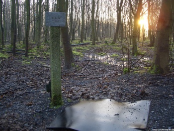
| FOTO = Gottfried_Wilhelm_Schacht_2_1.JPG | | FOTO = Gottfried_Wilhelm_Schacht_2_1.JPG | ||
| | | BILDBESCHREIBUNG1 = Gottfried Wilhelm Schacht 2 | ||
| NAME = Gottfried Wilhelm Schacht 2 | | NAME = Gottfried Wilhelm Schacht 2 | ||
| ALTERNATIVNAME = | | ALTERNATIVNAME = | ||
| Zeile 10: | Zeile 10: | ||
| AUFGEGEBEN_JAHR = 1972 | | AUFGEGEBEN_JAHR = 1972 | ||
| GRÖSSTE_TIEFE = | | GRÖSSTE_TIEFE = | ||
| DURCHMESSER = 4 | | DURCHMESSER = 4.60 | ||
| BAUART = | | BAUART = | ||
| NUTZUNG = | | NUTZUNG = | ||
| Zeile 23: | Zeile 23: | ||
| STRASSE = | | STRASSE = | ||
| NOCH_VORHANDEN = | | NOCH_VORHANDEN = | ||
| LAGE_UNSICHER = | |||
| LAGE_UNGENAU = | |||
}} | }} | ||
==Links== | ==Links== | ||
| Zeile 28: | Zeile 30: | ||
*[http://www.ruhrkohlenrevier.de/ob9178.html http://www.ruhrkohlenrevier.de/ob9178.html] | *[http://www.ruhrkohlenrevier.de/ob9178.html http://www.ruhrkohlenrevier.de/ob9178.html] | ||
[[Kategorie:Zeche Gottfried Wilhelm]] | [[Kategorie:Zeche Gottfried Wilhelm]] | ||
Aktuelle Version vom 22. Mai 2013, 22:09 Uhr
| Schachtdaten: Gottfried Wilhelm Schacht 2 | |
|---|---|
| Gottfried Wilhelm Schacht 2 | |
| Bergwerk | Gottfried Wilhelm |
| Schachtdurchmesser | 4,60 m |
| Teufbeginn | 1907 |
| Betriebsende | 1972 |
| Sichtbar | Schachtdeckel |
| Geographische Lage | |
| Standort | Essen |
| Gauss-Krüger-Koordinaten | R 25 72338.00 - H 56 98510.00 |
| Koordinaten | 51° 25′ 0″ N, 7° 2′ 21″ O51.4166167.039193Koordinaten: 51° 25′ 0″ N, 7° 2′ 21″ O |
|
| |
